Get the vector map you need in seconds,
not in three days of emails
Describe the map you want in plain English. Our AI cartographer draws it from real survey data and hands you a fully editable, layered SVG — no briefs, no proofing rounds, no waiting on a designer.
No account, no card. Pay £6 only if you love it.
Loved by designers, planners & print shops
your map appears here
There's a faster way
const time_to_map = "under a minute";
How it works
From a sentence to a print-ready file in three steps
STEP 1
Describe it
A town, a postcode, two villages, a radius, a scale. Plain English is the whole interface — no GIS knowledge needed.
STEP 2
Watch it draw
We resolve the location, pull survey-grade vector data at the right scale and compose a clean, labelled map. Redraw as often as you like — free.
STEP 3
Download the vectors
£6 with Stripe and every format lands instantly — layered SVG, print PDF, AI/EPS and high-res raster.
What you get
Real vectors. Not a screenshot of a map.
Every download is true geometry in a sane layer tree, so you can restyle roads, hide labels, drop in a client palette and print at any size without a single pixel showing up.
Editable SVG
Illustrator, Figma, Affinity, Inkscape. Named groups, live strokes.
Print-ready PDF
Vector PDF at your sheet size — straight to the printer.
AI / EPS
Native Illustrator and EPS for studios and repro houses.
PNG & JPG
High-res raster for slides, listings and the web.
Licensed and attributed properly
UK maps are built on Ordnance Survey data with the attribution you need included — use them in client work, brochures and planning submissions.
Examples
Real prompts, and what came back
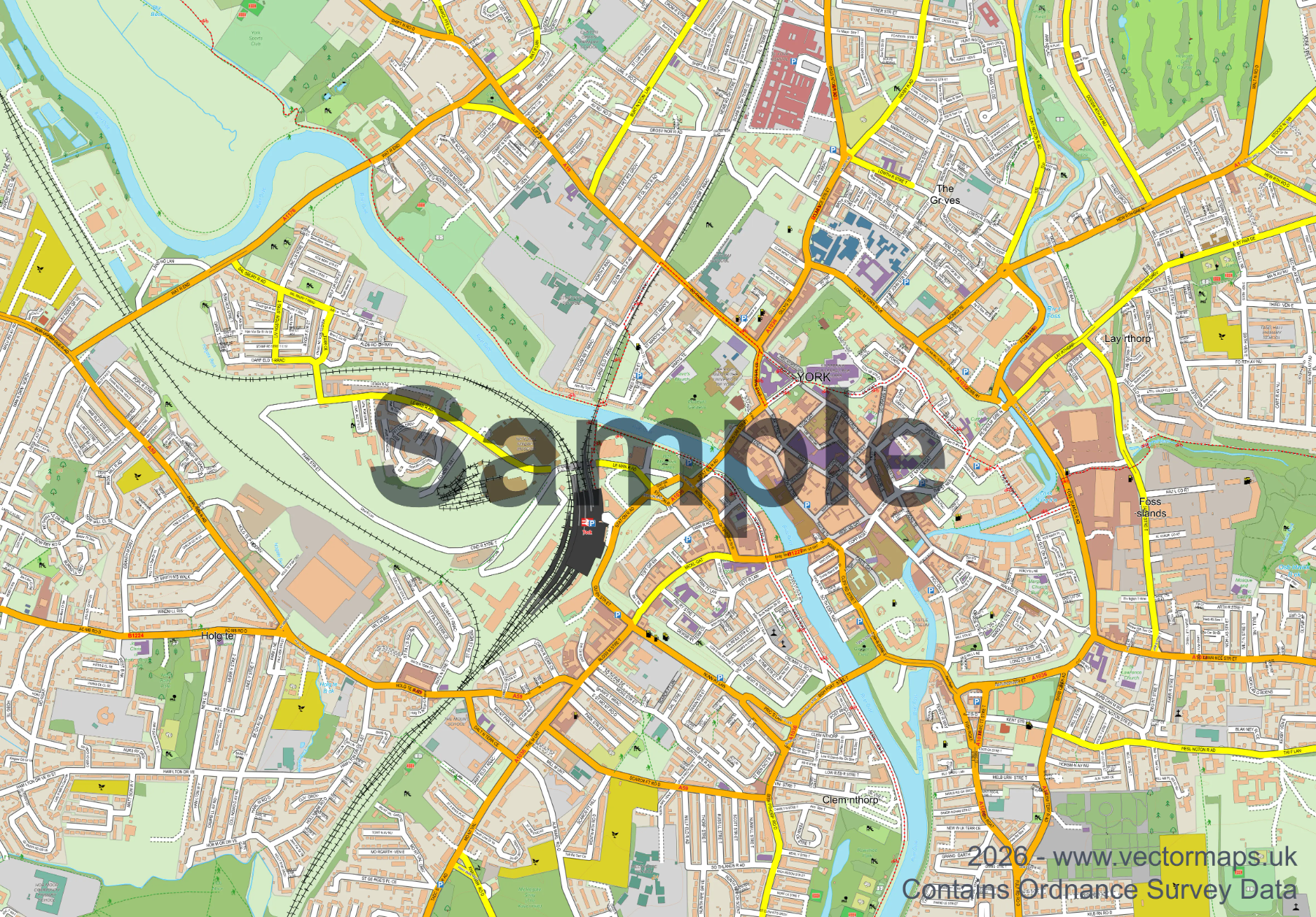
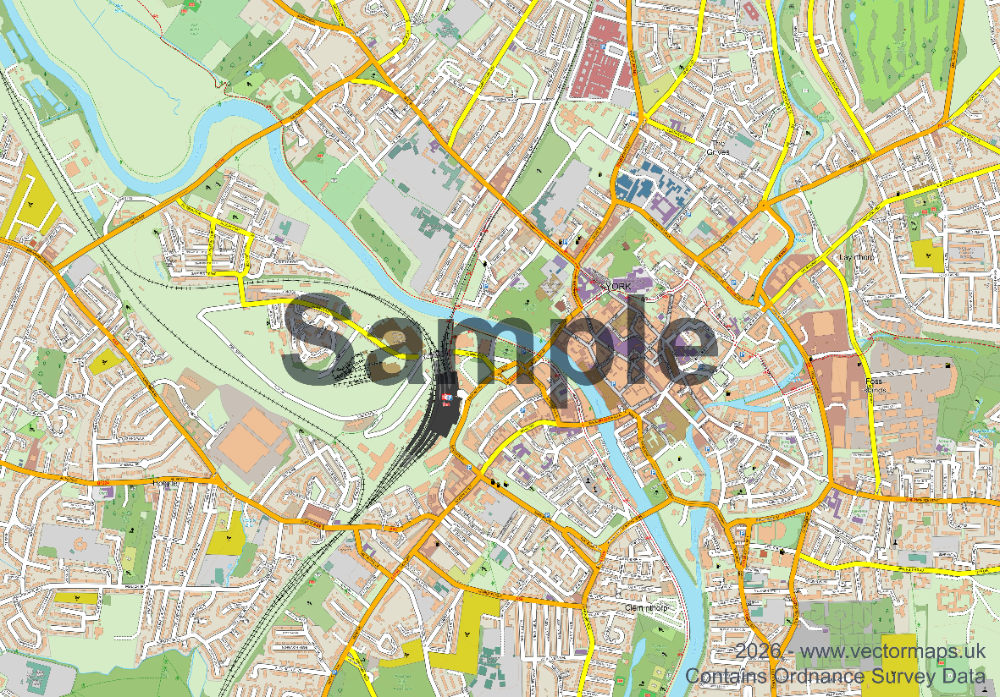
“I need a map showing 3 miles around York.”
York, North Yorkshire · fully layered, editable SVG
“A road map showing the YO18 7TG postcode.”
“Pickering and Thornton-le-Dale, North Yorkshire.”
“Site plan at 1:1250 with a red line round the plot.”
“A minimal black-and-white poster of central Bath.”
“The Cornish coast from Padstow to Newquay.”
Whatever you need a map for
Home & gifts
The street you grew up on, at poster scale and printed properly.
Designers
An editable base map to restyle into your own palette in minutes.
Planning
Location and site plans at the scales a submission expects.
Property
Clean area maps for brochures and listings, on brand every time.
Print shops
Sell any town on demand without a cartographer on call.
“I used to wait three days and two proofing rounds for a location plan. I typed one sentence and had the SVG before my coffee went cold.”
[Customer name]
Architect, Leeds
“The layer tree is what sold me. Roads on their own layer means I drop a client palette on and I'm done in ten minutes.”
[Customer name]
Graphic designer, Bristol
“I sell town prints. £6 a map and no back-and-forth means I can list a new place the same afternoon someone asks for it.”
[Customer name]
Poster shop owner, Norwich
Hey, I'm [your name] 👋
I've been drawing vector maps to order for years. The same thing happened every time: a customer knew exactly what they wanted, and it still took days of emails, sketches and proofs to get there.
So I taught the process to an AI. You describe the map, it draws it from the same survey-grade data I use, and you see it immediately. If it's wrong, say so and it redraws — no invoice for the extra round.
You only pay when the map on your screen is the one you wanted. That's the whole idea.
Pricing
Preview for free. Pay per map you keep.
Preview
Free
Unlimited prompts and redraws, watermarked on-screen preview. No account, no card.
Single map
One map, every format, yours to use commercially.
Secure checkout by Stripe
Credit bundles
Soon
Buy credits up front at a lower rate per map — for studios, agents and print shops making maps every week.
Frequently asked questions
Where does the map data come from?+
UK maps are built on Ordnance Survey data. Elsewhere we use equivalent national and open survey datasets. The attribution you need is included with every download.
Can I use the maps commercially?+
Yes — client work, printed products, planning submissions, brochures and marketing. You just can't resell the raw vector file on as a data product.
What if the map isn't what I asked for?+
Redraw it as many times as you like before paying. Change the radius, the scale, the area or the level of detail just by replying in the chat. You only ever buy a map you've already seen.
Which countries are covered?+
Worldwide. Detail is richest in the UK, where we have full Ordnance Survey coverage, and strong in urban areas everywhere else.
Are the files really editable?+
Yes. True vector geometry grouped into named layers — roads, water, buildings, green space, rail, labels, boundaries. Open the SVG in Illustrator, Figma, Affinity Designer or Inkscape and restyle it directly.
Do I need an account?+
Not to generate and preview. You only enter details at checkout, which is handled securely by Stripe.
How big can the map be printed?+
Any size. It's vector — A4 to billboard with no loss of quality. Tell the AI what sheet size you're printing at and it sets the PDF up for you.
Still stuck? Email us — a human replies.
One sentence. One map. Six pounds.
Describe what you need and see it before you decide. No account, no briefs, no proofing rounds.
Make my map — free previewFree to try · £6 only when you download